


LU MSA map (new version) 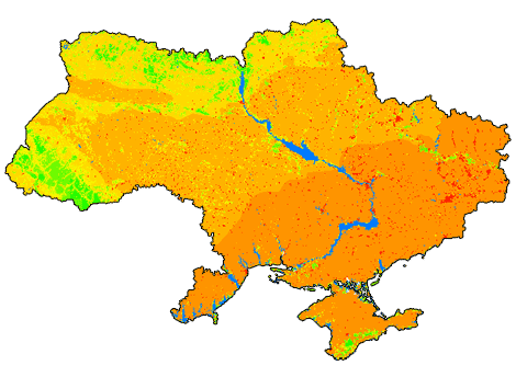 During the ‘GIS modular’ manual compilation new LU MSA (biodiversity loss from land use; picture above) was calculated. More details available because of a new approach: https://biomodel.info/?p=103 . You can compare the new LU MSA with LU MSA from previous run (picture below).
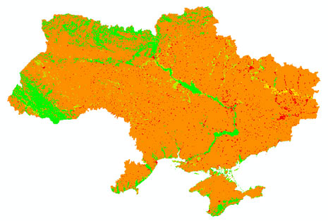
LU MSA map (previous version)
0 Comments