


(Ukraine natural zoning, nature zones of Ukraine, agriculture zones)
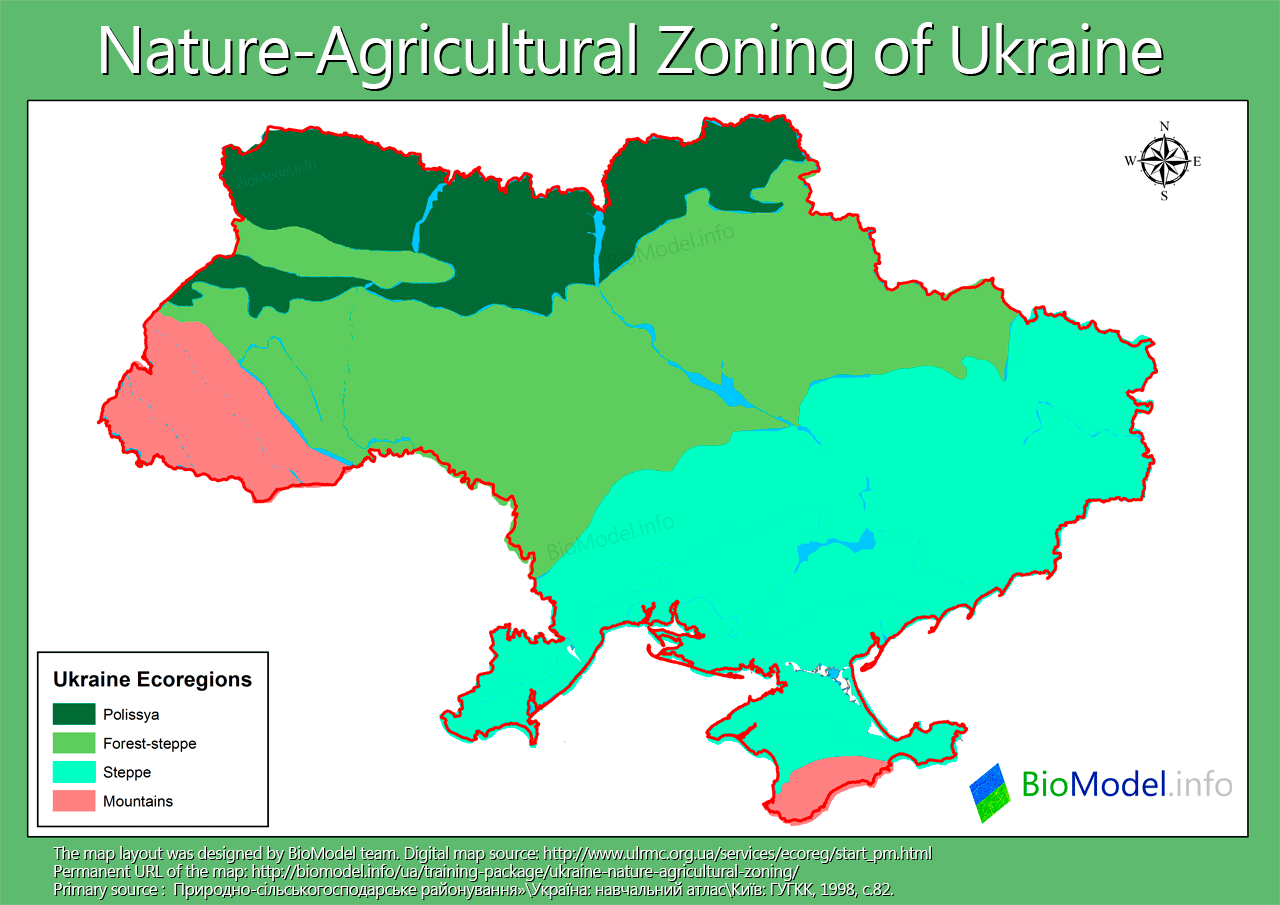
Northern part of Ukraine is a forest zone (Polissia), predominated with pine and oak trees. Forest-steppe zone, which is just south of the forest one and is more capable of sustaining agriculture. Steppe zone is situated in southern and eastern Ukraine. This zone is the most suitable for intensive agriculture. It is obvious that land use intensity and principles are unique for each zone. View Ukraine native zones map (new tab). There are different borders shown on maps within different sources. However, these potential uncertainties are insignificant on country scale.
 Download Polissia zone map in Google Earth format (compressed to zip): polissya_ua
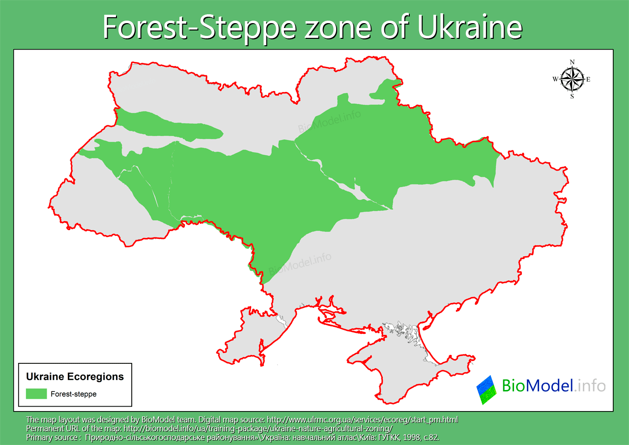 Download Forest-Steppe zone map in Google Earth format (compressed to zip): forest-steppe_ua
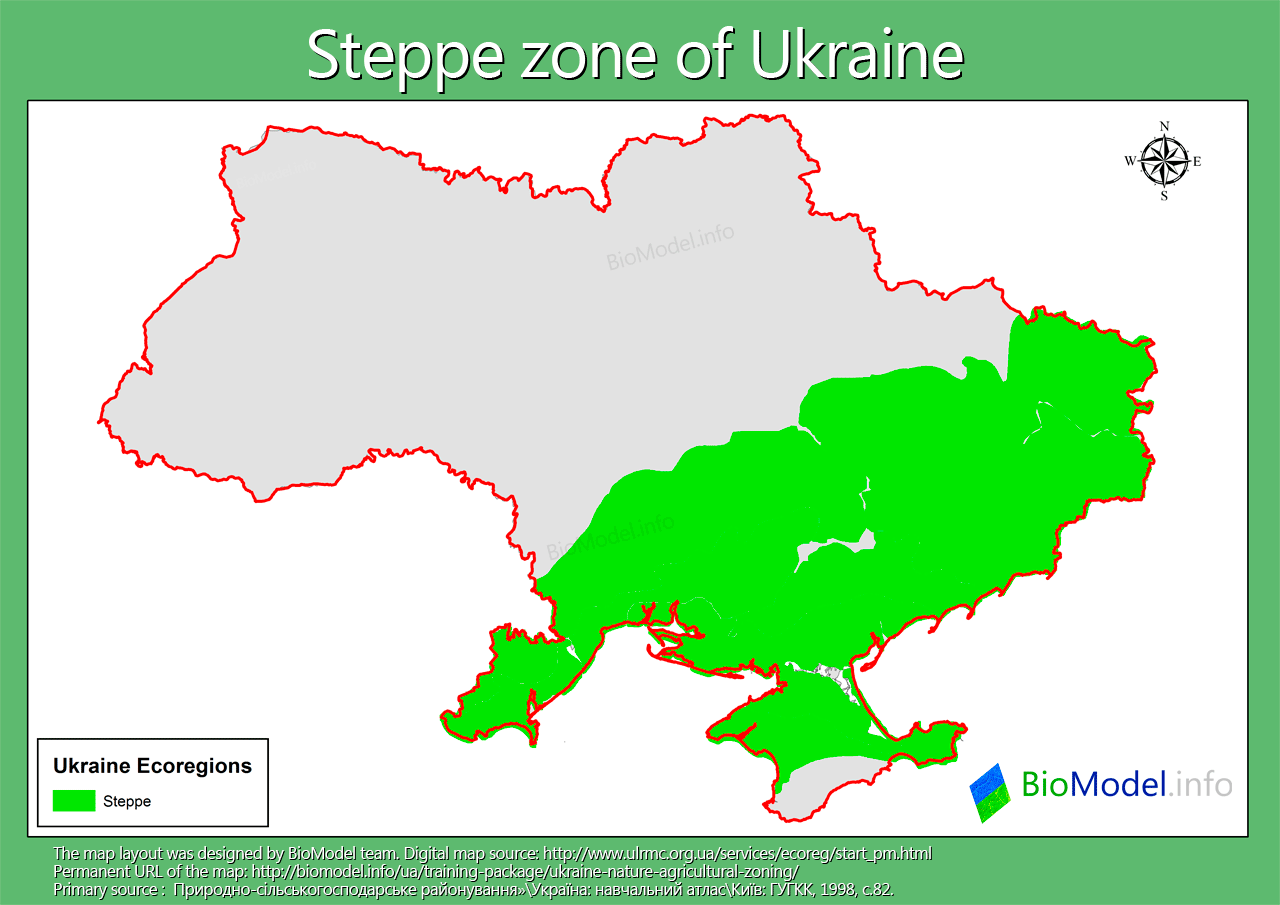 Download Steppe zone map in Google Earth format (compressed to zip): steppe_ua
Note: updated and detailed steppes map was used by BioModel to identify Great Bustard (Otis tarda) habitats.
Digital map source: http://www.ulrmc.org.ua/services/ecoreg/start_pm.html, Nature-Agricultural Zoning, and which is based on ‘Ukraine: Educational Atlas. Kyiv: ГУГКК, 1998, p. 82’, Ukr.
2 Comments
Grant Moore · Tuesday April 3rd, 2012 at 07:10 PM
Hello,
I am writing from Manitoba Education. We are currently developing a Grade 3 Ukrainian curriculum that will be distributed online, and would like to include copies of the four maps you have posted at https://biomodel.info/training-package/ukraine-nature-agricultural-zoning/.
Can you tell me how I can get permission to use this material?
Thank you,
Grant Moore
Grygoriy Kolomytsev · Thursday April 5th, 2012 at 03:00 AM
Hello,
You can use matherials from BioModel with reference to the website (complete url).