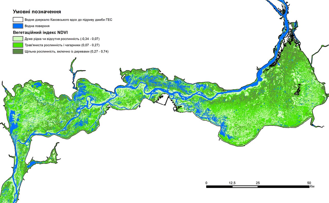
Grygorii Kolomytsev, Biomodel representative, an expert on spatial biodiversity modeling at the Ukrainian Nature Conservation Group and a researcher at the Schmalhausen Institute of Zoology of the National Academy of Sciences of Ukraine, talks about the map of vegetation on the territory of the former Kakhovka Reservoir.
Grygorii Kolomytsev: There have been many predictions that the territory of the Kakhovka Reservoir will turn into a desert. Perhaps it’s time to refute them not only with words, but with concrete observation data. To do this, I took relatively recent satellite images and used them to make a comprehensive assessment of how vegetation began to regenerate on the reservoir’s territory after it was drained.
According to my calculations based on the satellite images, less than a fifth of the surface that was previously covered by water is now underwater. Before the attack on the hydroelectric power plant, the water mirror of the Kakhovka reservoir was 2.1 thousand square kilometers, but as of August 19, only 382 square kilometers were under water. Completely different, new ecosystems have formed on this territory.
Please switch to Ukrainian to read the full article.