


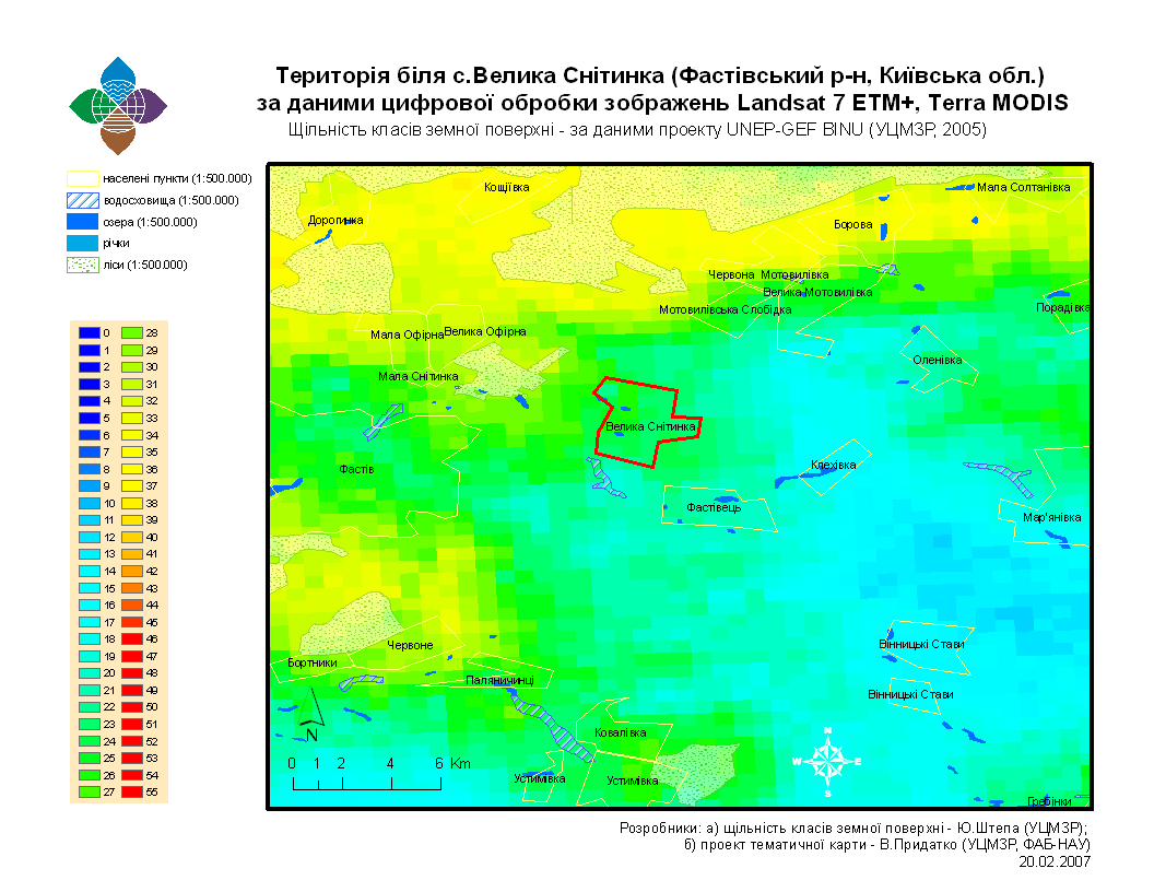
There is a supportive data for students of National University of Biological Resources and Life Sciences (Kyiv) on application of LCCD for purposes of a local model plot research i.e LCCD Zoom In – Near Velyka Sneetynka (Kyiv Oblast) – map. The area is located near Velyka Sneetynka village in Kyiv Oblast (Ukraine). Respective algorithm has been described by us in the monograph ‘Agrobiodiversity of Ukraine…’ (Ukr), see Book #1 – p.15-31, and Book #2 – p.165-194. NB: table 2 – page 188, and the picture – page 590 of the Book #2, and to the text, which narrate about LCCD-index importance due to its good potential to be converted then to numbers of plant or animal species directly. For the map we used LCCD-shape-file of GIS ‘Agrobio’, and settlements-shape-file of digital map 1:500000, and that was based on ESRI software (ArcMap 9.3). Students have to compare then LCCD and MSA indices using previous published results and information about its correlation. (For more details use BioModel searach window above, or page 63 and Picture #21 of our ‘Landscape Ecology…’ (2008) as well as the moddelling leaflet (A3).
Categories: Bd Training PackageModels Building Journal
0 Comments